Desert Online General Trading LLC
Dubai, United Arab Emirates
Desert Online General Trading LLC
Dubai, United Arab Emirates


Full description not available

A**R
Easy folded & quality paper
Excellent
N**H
Spit on
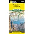
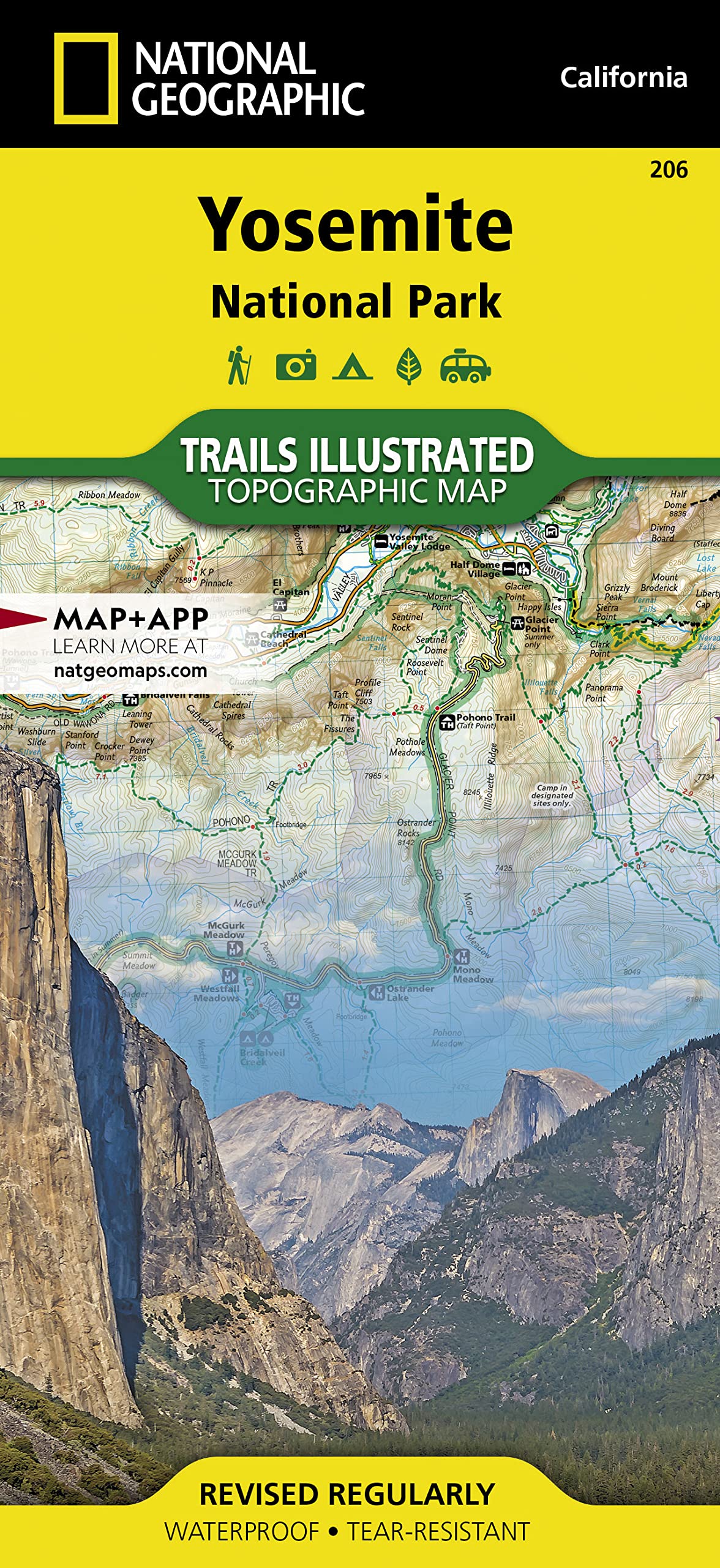
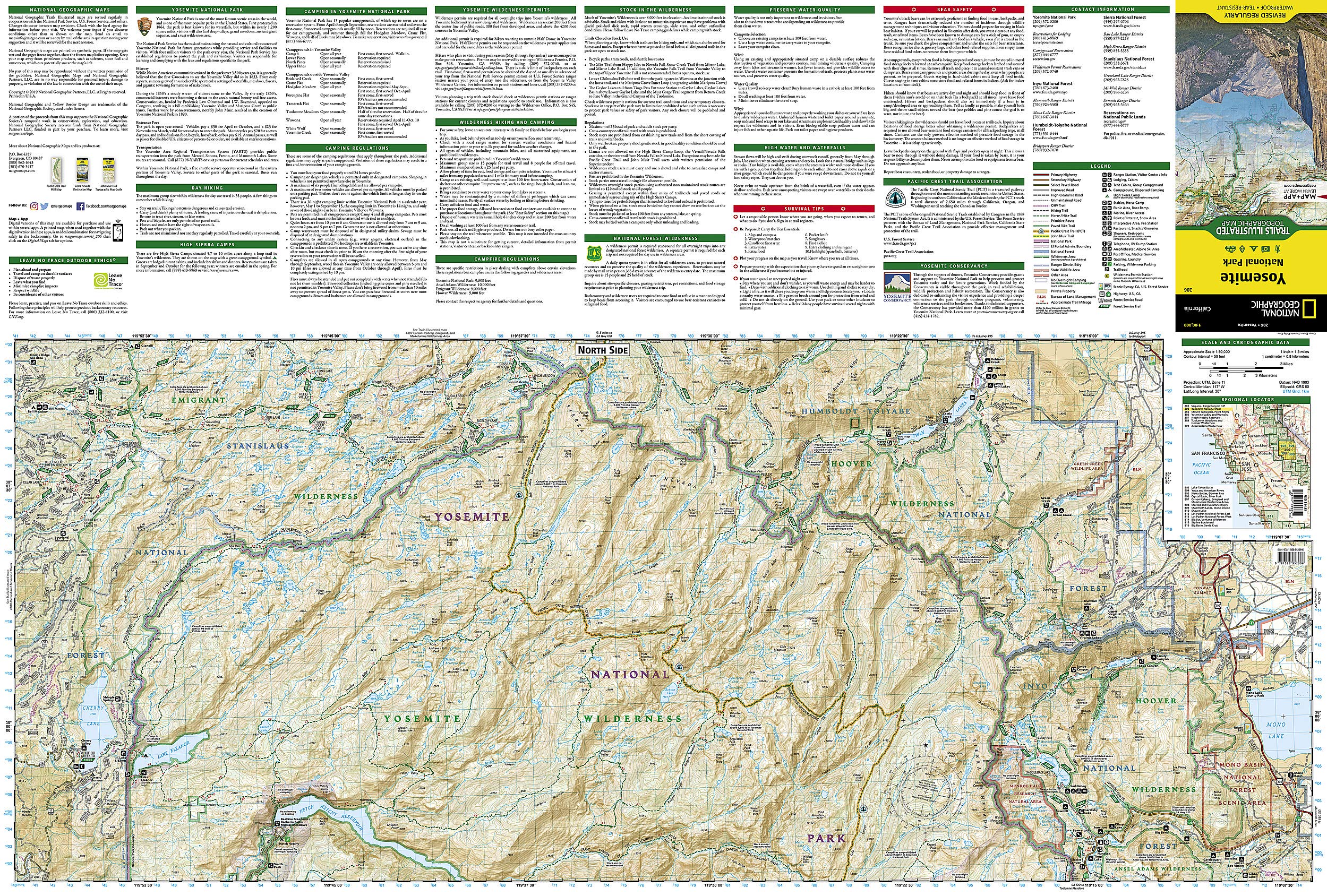
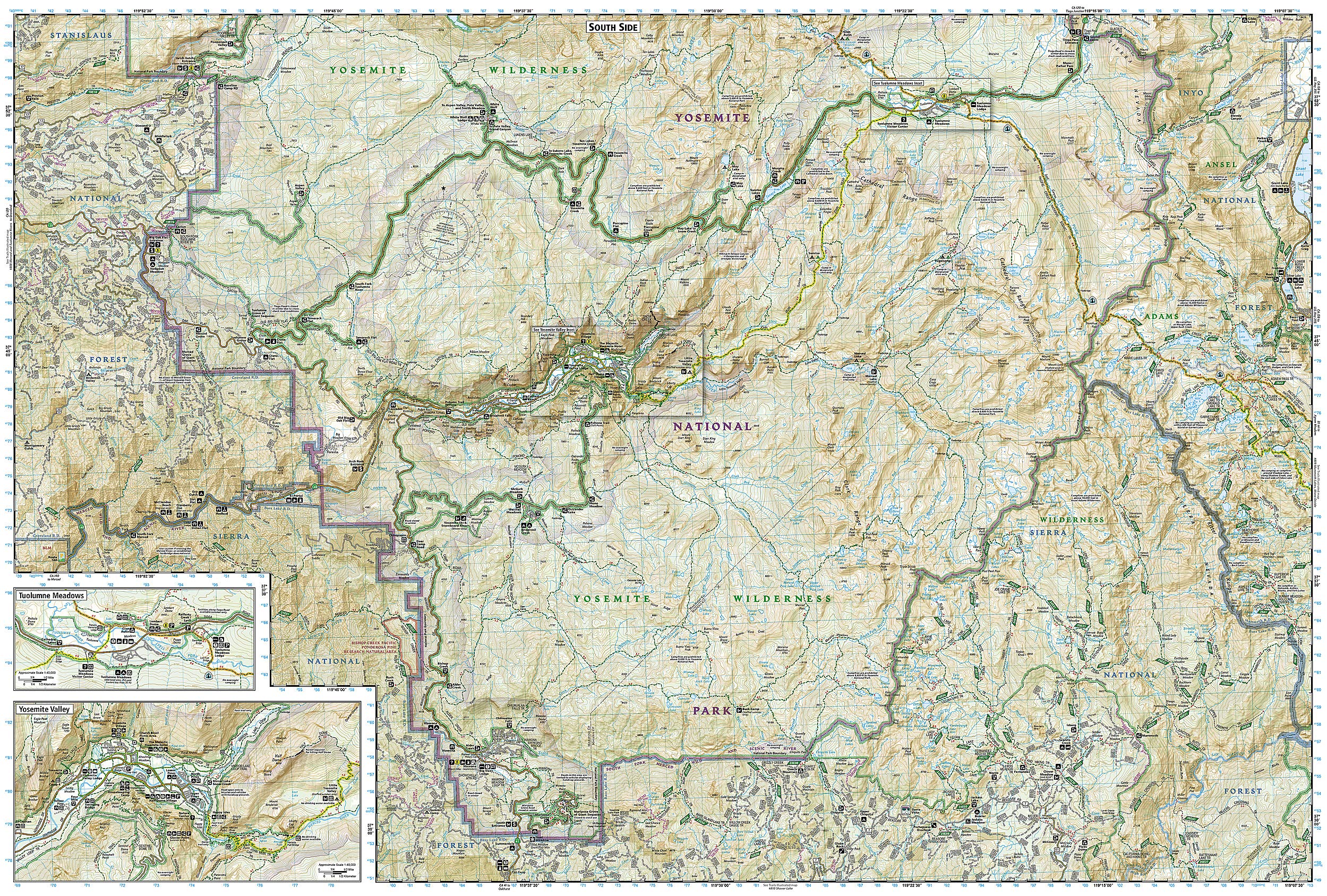
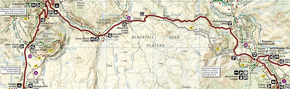
These maps are spot on. When your on the mountain, service can be spotty or even none. This map guided us 65 miles across Yosemite in 11 days backpack camping. Held up to water, held up to being opened and folded probably 100 times. Elevation was correct, mileage. Everything. I framed it with a bunch of pictures we took and drew out the route we did.
N**)
Easy to Read with Sufficient Details
I'm a long time Scouter and like having maps in addition to my trail apps. This is a durable map that greatly supplemented my digital navigation.
K**R
Yosemite map
Map was very useful, best for avid hikers. The free park map given out at the entrance was easier to navigate though for first time visitors.
J**R
Great map
We used this map for a backpacking trip in Yosemite this summer. We were also pleased to see that this was one of the maps they were selling in the ranger station. We used this map for planning our trip and brought it as reference throughout. The map is a little big, but that’s fine. We appreciated the insets for specific locations.
F**R
Helpful map, especially for such a massive park like Yosemite!
Now this is a must have. The park is just massive! Absolutely have to have the map, I haven’t visited the park yet, so I cannot really comment on accuracy and helpfulness, but with all the trails out there, especially the wilderness ones, I don’t see how anyone would make it without GPS and a plan B for when GPS doesn’t work. They will probably need to update the map once construction on some of the trails are complete, I know the trams are finally gone so we can go back to a natural trail setting with much more peace and quite, that’s the way it has to be to make sure we keep it the way we found it! Support your national parks! They are the best!
A**R
it is good enough
maybe i am weird but i like to have a topo map when i hike far enough off the the tourist routes (e.g. 20 miles round trip). As the park ranger said, this was her trusty topo map. A finer resolution map would have been appreciated on specific trails, but this is a good over view map for most trips to the park for your initial visits. And if you get as far away from civilization as i do, an "old school" backup to whatever your favorite electronic navigation app is worth the weight and space.
C**K
Perfect
I really love nat geo's trail maps, this things can hold up really well. I had a stack of them out on this last trip through the southwest. Its not mine if I haven't spilled coffee on it yet apparently well knocked a cup over right on the maps at first I freaked out but after a quick trying and leaving in the sun the maps weren't even phased.As for the map itself, I carry them on all my hikes and haven't been disappointed when i have to use them on the trails. Another thing I use them for is planning my photography shots, it gives me a bigger picture of everything so I know what the terrain looks like, what direction each "viewpoint" is before I ever get to the parks
Trustpilot
3 days ago
4 days ago